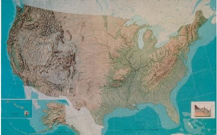
Cartography
Cartography is the art of making maps. A map is a two-dimensional (flat) drawing or chart showing the political boundaries and physical features of a geographical region. For example, a map may show the location of cities, mountain ranges, and rivers, or may show the types of rock in a given region. Cartography is considered a subdiscipline of geography, which is the study of Earth's surface and its various climates, continents, countries, and resources.
The history of cartography
The oldest known map is of an area in northern Mesopotamia, an ancient region in southwest Asia. The baked clay tablet, found near present-day Nuzi, Iraq, dates from approximately 3800 B.C. Fragments of clay maps nearly 4,000 years old have been found in other parts of Mesopotamia, some showing city plans and others showing parcels of land. Over 3,000 years ago, the ancient Egyptians surveyed the lands in the Nile Valley. They drew detailed maps on papyrus for use in taxation.
The ancient Greeks developed many of the basic principles of modern cartography, including latitude and longitude, and map projections. The maps of Ptolemy, a Greek astronomer and mathematician who lived in the second century A.D. , are considered the high point of Greek cartography.
The era of European exploration that arose in the 1500s supplied cartographers with a wealth of new information, which allowed them to produce maps and navigation charts of ever-increasing accuracy and detail. Europeans became fascinated with the idea of mapping the world. The French initiated the first national survey during the 1700s, and soon other European countries followed suit. Today, most countries have an official organization devoted to cartographic research and production.
Mapmaking
No single map can accurately show every feature on Earth's surface. There is simply too much spatial information at any particular point
for all of the information to be presented in a comprehensible, usable format. Maps show the location of selected phenomena by using symbols that are identified in a legend.
Maps are smaller than the area they depict: they present various pieces of geographical information at a reduced scale. Every map has a statement of its scale, which is an expression of the ratio between map distance and actual distance. This statement can take many forms, and many maps express scale in more than one way. The graphic scale is a line or bar showing how many actual miles or kilometers are represented by a particular number of inches or centimeters on the map. Another scale indicates distance as a ratio between two points on the map and their actual geographical distance. For example, a map with a scale of 1:100,000 tells the map reader that every 1 unit of distance on the map equals 100,000 of the same units of distance on the ground. In this example, 1 inch or centimeter on the map would equal 100,000 inches or centimeters in actual ground distance.
Cartographers traditionally obtained their information from navigators and surveyors. For many centuries maps were produced entirely by hand. They were drawn or painted on paper, hide, parchment, clay tablets, and slabs of wood. Each map was an original work. Once the printing press was developed in Europe in the 1400s, many reproductions were made from an original work. Maps became more common and more accessible.
Various techniques were integrated into the printing process during the last 200 years, increasing the variety of scales at which maps were produced. The introduction of the lithographic printing method in the late 1800s brought about the production of multicolored maps. Today, cartographers incorporate information from aerial photography and satellite imagery in the maps they create. They also use computer-assisted design programs to produce map images.
[ See also Geologic map ]
Comment about this article, ask questions, or add new information about this topic: