Remote Sensing - How it works
An Introduction to Remote Sensing
The work of geologists would be much easier if Earth were transparent and they could simply look down into the ground as they would into the sky. But the ground is not transparent; nor, for that matter, is the sky, to which meteorologists look for information regarding atmospheric and weather patterns. Some places are hard to see, and many are difficult or even impossible to visit physically. Some places, such as the Sun or the Earth's core, could not be approached physically even by unmanned technology.
Hence the need for remote sensing, or the gathering of data without actual contact with the materials or objects being studied. Some earth scientists define the term more narrowly, restricting "remote sensing" to the use of techniques involving radiation on the electromagnetic spectrum. The latter category includes visible, infrared, and ultraviolet light as well as lower-frequency signals in the microwave range of the spectrum. This definition excludes the study of force fields involving gravitational or electromagnetic force. In general, in this essay we abide by that more narrow definition, primarily because most forms of remote sensing in use today involve electromagnetic radiation.
Remote sensing is used for a variety of measuring and mapping applications. The reader therefore is encouraged to consult the essay Measuring and Mapping Earth for more on this subject. Applications of remote sensing go far beyond cartography (mapmaking) and measurement, however. As suggested already, remote sensing makes it possible for earth scientists to collect data from places they could not possibly go. In addition, it allows for data collection in places where a human being would be "unable to see the forest for the trees"—which in places such as the Amazon valley is quite literally the case.
The Military Influence
Scientists' understanding of the electromagnetic spectrum was still in its infancy in 1849, when the French army engineer Aimé Laussedat (1819-1907) introduced what was then called iconometry, from the Greek words icon ("image") and -metry ("measurement"). Laussedat, who experimented with aerial photography
A few years later, the United States armies of the Civil War adopted the use of aerial photography for surveillance purposes, mounting cameras on balloons to provide intelligence regarding federal or Confederate positions and troop strength. This fact, combined with Laussedat's status as an army engineer, hints at one of the underlying themes in the history of remote sensing, and indeed of many another technological advance: the influence of the military. It is a fact of human existence that nations from at least the time of the Assyrians, if not the Egyptians of the New Kingdom, have devoted far more attention and resources to military applications than they have to peacetime activities.
On the other hand, societies have benefited enormously from technological and organizational innovations with military origins, innovations whose application later spread to a variety of peacetime uses. Some examples include the adoption of the chariot by the Egyptian army after the Hyksos invasion ( ca. 1670 B.C. ); the Assyrian introduction of logistics in an effort to supply imperial troops ( ca. 800 B.C. ); the Persian development of the postal service ( ca. 600 B.C. ); numerous Roman innovations, particularly in road building ( ca. 200 B.C. - ca. A.D. 200); and the Chinese invention of the wheelbarrow ( ca. 100 B.C. ). And so the list goes, right up to such latter-day American developments as the Internet and GPS, or global positioning system.
MILITARY CONTRIBUTIONS TO REMOTE SENSING.
Forms of technology pioneered by military forces and now used in remote sensing include infrared photography, thermal imagery, radar scanning, and satellites. The first of these types of technology makes use of light in the infrared portion of the electromagnetic spectrum—a region that, as its name suggests, is adjacent to the red portion of visible light. Red has the longest wavelength and the lowest frequency of all colors, and infrared has an even longer wavelength and lower frequency. Military forces use infrared photography to distinguish between vegetation and camouflage designed to look like vegetation: live plants reflect infrared radiation, whereas dead ones and camouflaged material absorb it.
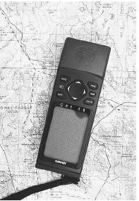
Whereas infrared photography measures reflection of infrared radiation, thermal imaging indicates the amount of such radiation that is emitted by the source. Its military origins lie in its use for reconnaissance during night bombing missions. Similarly, radar scanning makes it possible to view targets on the ground, regardless of lighting or cloud cover. Finally, there are satellites, which have extensive surveillance applications. Among the most important examples of military activity above Earth's atmosphere are the 24 satellites of GPS, which make allow U.S. forces to plot positions with amazing accuracy. Less accurate GPS intelligence is also available to civilians. (See Measuring and Mapping Earth for more on GPS.)
Comment about this article, ask questions, or add new information about this topic: