PLATE TECTONICS
CONCEPT
The earth beneath our feet is not dead; it is constantly moving, driven by forces deep in its core. Nor is the planet's crust all of one piece; it is composed of numerous plates, which are moving steadily in relation to one another. This movement is responsible for all manner of phenomena, including earthquakes, volcanoes, and the formation of mountains. All these ideas, and many more, are encompassed in the concept of plate tectonics, which is the name for a branch of geologic and geophysical study and for a powerful theory that unites a vast array of ideas. Plate tectonics works hand in hand with several other striking concepts and discoveries, including continental drift and the many changes in Earth's magnetic field that have taken place over its history. No wonder, then, that this idea, developed in the 1960s but based on years of research that preceded that era, is described as "the unifying theory of geology."
HOW IT WORKS
TECTONICS AND TECTONISM
The lithosphere is the upper layer of Earth's interior, including the crust and the brittle portion at the top of the mantle. Tectonism is the deformation of the lithosphere, and the term tectonics refers to the study of this deformation, including its causes and effects, most notably mountain building. This deformation is the result of the release and redistribution of energy from Earth's core.
The interior of Earth itself is divided into three major sections: the crust, mantle, and core. The first is the uppermost division of the solid earth, representing less than 1% of its volume and varying in depth from 3 mi. to 37 mi. (5-60 km). Below the crust is the mantle, a thick, dense layer of rock approximately 1,429 mi. (2,300 km) thick. The core itself is even more dense, as illustrated by the fact that it constitutes about 16% of the planet's volume and 32% of its mass. Composed primarily of iron and another, lighter element (possibly sulfur), it is divided between a solid inner core with a radius of about 760 mi. (1,220 km) and a liquid outer core about 1,750 mi. (2,820 km) thick.
Tectonism results from the release and redistribution of energy from Earth's interior. There are two components of this energy: gravity, a function of the enormous mass at the core, and heat from radioactive decay. (For more about gravity, see Gravity and Geodesy. The heat from Earth's core, the source of geothermal energy, is discussed in Energy and Earth.) Differences in mass and heat within the planet's interior, known as pressure gradients, result in the deformation of rocks.
DEFORMATION OF ROCKS.
Any attempt to deform an object is referred to as stress, and stress takes many forms, including tension, compression, and shear. Tension acts to stretch a material, whereas compression—a type of stress produced by the action of equal and opposite forces, whose effect is to reduce the length of a material—has the opposite result. (Compression is a form of pressure.) As for shear, this is a kind of stress resulting from equal and opposite forces that do not act along the same line. If a thick, hardbound book is lying flat and one pushes the front cover from the side so that the covers and pages are no longer perfectly aligned, this is an example of shear.
Under the effects of these stresses, rocks may bend, warp, slide, or break. They may even flow, as though they were liquids, or melt and thus truly become liquid. As a result, Earth's interior may manifest faults, or fractures in rocks, as well as folds, or bends in the rock structure. The effects of this activity can be seen on the surface in the form of subsidence, which is a depression in the crust, or uplift, which is the raising of crustal materials. Earthquakes and volcanic eruptions also may result.
There are two basic types of tectonism: orogenesis and epeirogenesis. Orogenesis is taken from the Greek words oros ("mountain") and genesis ("origin") and involves the formation of mountain ranges by means of folding, faulting, and volcanic activity. The Greek word epeiros means "mainland," and epeirogenesis takes the form of either uplift or subsidence. Of principal concern in the theory of plate tectonics, as we shall see, is orogenesis, which involves more lateral, as opposed to vertical, movement.
CONTINENTAL DRIFT
If one studies a world map for a period of time, one may notice something interesting about the shape of Africa's west coast and that of South America's east coast: they seem to fit together like pieces of a jigsaw puzzle. Early in the twentieth century, two American geologists, Frank Bursley Taylor (1860-1938) and Howard Baker, were among the first scientists to point out this fact. According to Taylor and Baker, Europe, the Americas, and Africa all had been joined at one time. This was an early version of continental drift, a theory concerning the movement of Earth's continents.
Continental drift is based on the idea that the configuration of continents was once different than it is today, that some of the individual landmasses of today once were joined in other continental forms, and that the landmasses later moved to their present locations. Though Taylor and Baker were early proponents, the theory is associated most closely with the German geophysicist and meteorologist Alfred Wegener (1880-1930), who made the case for continental drift in The Origin of Continents and Oceans (1915).
PANGAEA, LAURASIA, AND GONDWANALAND.
According to Wegener, the continents of today once formed a single supercontinent called Pangaea, from the Greek words pan ("all") and gaea ("Earth"). Eventually, Pangaea split into two halves, with the northern continent of Laurasia and the southern continent of Gondwanaland, sometimes called Gondwana, separated by the Tethys Sea. In time, Laurasia split to form North America, the Eurasian land-mass with the exception of the Indian subcontinent, and Greenland. Gondwanaland also split, forming the major southern landmasses of the world: Africa, South America, Antarctica, Australia, and India.
The Austrian geologist Eduard Suess (1831-1914) and the South African geologist Alexander du Toit (1878-1948), each of whom contributed significantly to continental drift theory, were responsible for the naming of Gondwanaland and Laurasia, respectively. Suess preceded Wegener by many years with his theory of Gondwanaland, named after the Gondwana region of southern India. There he found examples of a fern that, in fossilized form, had been found in all the modern-day constituents of the proposed former continent. Du Toit, Wegener's contemporary, was influenced by continental drift theory and improved on it greatly.
FORMATION OF THE CONTINENTS.
Today continental drift theory is accepted widely, in large part owing to the development of plate tectonics, "the unifying theory in geology." We examine the evidence for continental drift, the arguments against it, and the eventual triumph of plate tectonics in the course of this essay. Before going on, however, let us consider briefly the now-accepted timeline of events described by Wegener and others.
About 1,100 million years ago (earth scientists typically abbreviate this by using the notation 1,100 Ma), there was a supercontinent named Rodinia, which predated Pangaea. It split into Laurasia and Gondwanaland, which moved to the northern and southern extremes of the planet, respectively. Starting at about 514 Ma, Laurasia drifted southward until it crashed into Gondwanaland about 425 Ma. Pangaea, surrounded by a vast ocean called Panthalassa ("All Ocean"), formed approximately 356 Ma.
In the course of Pangaea's formation, what is now North America smashed into northwestern
By about 152 Ma, in the late Jurassic period, the continents as we know them today began to take shape. By about 65 Ma, all the present continents and oceans had been formed for the most part, and India was drifting north, eventually smashing into southern Asia to shape the world's tallest mountains, the Himalayas, the Karakoram Range, and the Hindu Kush. This process is not finished, however, and geologists believe that some 250-300 million years from now, Pangaea will re-form.
EVIDENCE AND ARGUMENTS.
As proof of his theory, Wegener cited a wide variety of examples, including the apparent fit between the coastlines of South America and western Africa as well as that of North America and northwestern Africa. He also noted the existence of rocks apparently gouged by glaciers in southern Africa, South America, and India, far from modern-day glacial activity. Fossils in South America matched those in Africa and Australia, as Suess had observed. There were also signs that mountain ranges continued between continents—not only those apparently linking North America and Europe but also ranges that seemed to extend from Argentina to South Africa and Australia.
By measurements conducted over a period of years, Wegener even showed that Greenland was drifting slowly away from Europe, yet his theory met with scorn from the geoscience community of his day. If continents could plow through oceanic rock, some geologists maintained, then they would force up mountains so high that Earth would become imbalanced. As for his claim that matching fossils in widely separated regions confirmed his theory of continental drift, geologists claimed that this could be explained by the existence of land bridges, now sunken, that once had linked those areas. The apparent fit between present-day landmasses could be explained away as coincidence or perhaps as evidence that Earth simply was expanding, with the continents moving away from one another as the planet grew.
INTRODUCTION TO PLATE TECTONICS
Though Wegener was right, as it turned out, his theory had one major shortcoming: it provided no explanation of exactly how continental drift had occurred. Even if geologists had accepted his claim that the continents are moving, it raised more questions than answers. A continent is a very large thing simply to float away; even an aircraft carrier, which is many millions of times lighter, has to weigh less than the water it displaces, or it would sink like a stone. In any case, Wegener never claimed that continents floated. How, then, did they move?
The answer is plate tectonics, the name both of a theory and of a specialization of tectonics. As an area of study, plate tectonics deals with the large features of the lithosphere and the forces that fashion them. As a theory, it explains the processes that have shaped Earth in terms of plates (large movable segments of the lithosphere) and their movement. Plate tectonics theory brings together aspects of continental drift, seafloor spreading (discussed later), seismic and volcanic activity, and the structures of Earth's crust to provide a unifying model of Earth's evolution.
It is hard to overemphasize the importance of plate tectonics in the modern earth sciences; hence, its characterization as the "unifying theory." Its significance is demonstrated by its inclusion in the book The Five Biggest Ideas of Science, cited in the bibliography for this essay. Alongside plate tectonics theory in that volume are four towering concepts of extraordinary intellectual power: the atomic model, or the concept that matter is made up of atoms; the periodic law, which explains the chemical elements; big bang theory, astronomers' explanation of the origins of the universe (see Planetary Science); and the theory of evolution in the biological sciences.
THE PIECES COME TOGETHER.
In 1962 the United States geologist Harry Hammond Hess (1906-1969) introduced a new concept that would prove pivotal to the theory of plate tectonics: seafloor spreading, the idea that seafloors crack open along the crest of mid-ocean ridges and that new seafloor forms in those areas. (Another American geologist, Robert S. Dietz [1914-1995], had published his own theory of seafloor spreading a year before Hess's, but Hess apparently developed his ideas first.) According to Hess, a new floor forms when molten rock called magma rises up from the asthenosphere, a region of extremely high pressure underlying the lithosphere, where rocks are deformed by enormous stresses. The magma wells up through a crack in a ridge, runs down the sides, and solidifies to form a new floor.
Three years later, the Canadian geologist John Tuzo Wilson (1908-1993) coined the term plates to describe the pieces that make up Earth's rigid surface. Separated either by the mid-ocean rifts identified earlier by Heezen or by mountain chains, the plates move with respect to one another. Wilson presented a model for their behavior and established a global pattern of faults, a sort of map depicting the movable plates. The pieces of a new theory were forming (an apt metaphor in this instance!), but as yet it had no name.
That name appeared in 1967, when D. P. Mackenzie of England and R. L. Parker of the United States introduced the term plate tectonics. They maintained that the surface of Earth is divided into six major as well as seven minor movable plates and compared the continents to enormous icebergs—much as Wegener had described them half a century earlier. Subsequent geologic research has indicated that there may be as many as nine major plates and as many as 12 minor ones.
To test these emerging ideas, the U.S. National Science Foundation authorized a research voyage by the vessel Glomar Challenger in 1968. On their first cruise, through the Gulf of Mexico and the Atlantic, the Challenger 's scientific team collected sediment, fossil, and crust samples that confirmed the basics of seafloor spreading theory. These results led to new questions regarding the reactions between rocks and the heated water surrounding them, spawning new research and necessitating additional voyages. In the years that followed, the Challenger made more and more cruises, its scientific teams collecting a wealth of evidence for the emerging theory of plate tectonics.
REAL-LIFE APPLICATIONS
EARLY EVIDENCE OF PLATE TECTONICS
No single person has been as central to plate tectonics as Wegener was to continental drift or as the English naturalist Charles Darwin (1809-1882) was to evolution. The roots of plate tectonics lie partly in the observations of Wegener and other proponents of continental drift as well as in several discoveries and observations that began to gather force in the third quarter of the twentieth century.
During World War II, submarine warfare necessitated the development of new navigational technology known as sonar (SO und N avigation A nd R anging). Sonar functions much like radar (see Remote Sensing), but instead of using electromagnetic waves, it utilizes ultrasonic, or high-frequency, sound waves projected through water. Sonar made it feasible for geologists to study deep ocean basins after the war, making it possible for the first time in history to map and take samples from large areas beneath the seas. These findings raised many questions, particularly concerning the vast elevation differences beneath the seas.
EWING AND THE MOUNTAINS UNDER THE OCEAN.
One of the first earth scientists to notice the curious aspects of underwater geology was the American geologist William Maurice Ewing (1906-1974), who began his work long before the war. He had gained his first experience in a very practical way during the 1920s, as a doctoral student putting himself through school. Working summers with oil exploration teams in the Gulf of Mexico off the coast of Texas had given him a basic understanding of the subject, and in the following decade he went to work exploring the structure of the Atlantic continental shelf and ocean basins.
His work there revealed extremely thick sediments covering what appeared to be high mountainous regions. These findings sharply contradicted earlier ideas about the ocean floor, which depicted it as a flat, featureless plain rather like the sandy-bottomed beaches found in resort areas. Instead, the topography at the bottom of the ocean turned out to be at least as diverse as that of the land above sea level.
HEEZEN AND THE RIFT VALLEY.
During the 1950s, a team led by another American geologist, Bruce Charles Heezen (1924-1977), worked on developing an overall picture of the ocean basin's topography. Earlier work had identified a mountain range running the length of the Atlantic, but Heezen's team discovered a deep valley down the middle of the chain, running parallel to it. They described it as a rift valley, a long trough bounded by two or more faults, and compared it to a similar valley in eastern Africa.
Around the same time, a group of transatlantic telephone companies asked Heezen to locate areas of possible seismic or earthquake activity in the Atlantic. Phone company officials reasoned that if they could find the areas most likely to experience seismic activity, they could avoid placing their cables in those areas. As it turned out, earthquakes tended to occur in exactly the same region that Heezen and his team had identified as the rift valley.
THE PLATES AND THEIR INTERACTIONS
The most significant plates that make up Earth's surface are as follows:
Selected Major Plates
- North American (almost all of North America and Mexico, along with Greenland and the northwestern quadrant of the Atlantic)
- South American (all of South America and the southwestern quadrant of the Atlantic)
- African (Africa, the southeastern Atlantic, and part of the Indian Ocean)
- Eurasian (Europe and Asia, excluding the Indian subcontinent, along with surrounding ocean areas)
- Indo-Australian (India, much of the Indian Ocean, Australia, and parts of the Indonesian archipelago and New Zealand)
- Antarctic (Antarctica and the Antarctic Ocean)
In addition to these plates, there are several plates that while they are designated as "major" are much smaller: the Philippine, Arabian, Caribbean, Nazca (off the west coast of South America), Cocos (off the west coast of Mexico), and Juan de Fuca (extreme western North America). Japan, one of the most earthquake-prone nations in the world, lies at the nexus of the Philippine, Eurasian, and Pacific plates.
MOVEMENT OF THE PLATES.
One of the key principles of geology, discussed elsewhere in this book, is uniformitarianism: the idea that processes occurring now also occurred in the past. The reverse usually is also true; thus, as we have noted, the plates are still moving, just as they have done for millions of years. Thanks to satellite remote sensing, geologists are able to measure this rate of movement. (See Remote Sensing for more on this subject.) Not surprisingly, its pace befits the timescale of geologic, as opposed to human, processes: the fastest-moving plates are careening forward at a breathtaking speed of 4 in. (10 cm) per year. The ground beneath Americans' feet (assuming they live in the continental United States, east of the Juan de Fuca) is drifting at the rate of 1.2 in. (3 cm) every year, which means that in a hundred years it will have shifted 10 ft. (3 m).
WHEN PLATES INTERACT.
Plates interact by moving toward each other (convergence), away from each other (divergence), or past each other (transform motion). Convergence usually is associated with subduction, meaning that one plate is forced down into the mantle and eventually undergoes partial melting. This typically occurs in the ocean, creating a depression known as an oceanic trench. Divergence results in the separation of plates and most often is associated either with seafloor spreading or the formation of rift valleys.
There are three types of plate margins, or boundaries between plates, depending on the two types of crusts that are interacting: oceanic with oceanic, continental with continental, or continental with oceanic. The rift valleys of the Atlantic are an example of an oceanic margin where divergence has occurred, while oceanic convergence is illustrated by a striking example in the Pacific. There, subduction of the Philippine Plate by the Pacific Plate has created the Mariana Trench, which at 36,198 ft. (10,911 m) is the deepest depression on Earth.
When continental plates converge, neither plate subducts; rather, they struggle against each other like two warriors in a fight to the death, buckling, folding, and faulting to create huge mountain ranges. The convergence of the Indo-Australian and Eurasian plates has created the highest spots on Earth, in the Himalayas, where Mount Everest (on the Nepal-Indian border) rises to 29,028 ft. (8,848 m). Continental plates also may experience divergence, resulting in the formation of seas. An example is the Red Sea, formed by the divergence of the African and Arabian plates.
Given these facts about the interactions of oceanic and continental plates with each other, what occurs when continental plates meet oceanic ones is no surprise. In this situation, the oceanic plate meeting the continental plate is like a high-school football player squaring off against a National Football League pro tackle. It is no match: the oceanic plate easily subducts. This leads to the formation of a chain of volcanoes along the continental crust, examples being the Cascade Range in the U.S. Pacific Northwest (Juan de Fuca and Pacific plates) or the Andes (South American and Nazca plates).
Transform margins may occur with any combination of oceanic or continental plates and result in the formation of faults and earthquake zones. Where the North American Plate slides against the Pacific Plate along the California coast, it has formed the San Andreas Fault, the source of numerous earthquakes, such as the dramatic San Francisco quakes of 1906 and 1989 and the Los Angeles quake of 1994.
PALEOMAGNETISM
As noted earlier, plate tectonics brings together numerous areas of study in the geologic sciences that developed independently but which came to be seen as having similar roots and explanations. Among these disciplines is paleomagnetism, an area of historical geology devoted to studying the direction and intensity of magnetic fields in the past, as discerned from the residual magnetization of rocks.
Earth has a complex magnetic field whose principal source appears to be the molten iron of the outer core. In fact, the entire planet is like a giant bar magnet, with a north pole and a south pole. It is for this reason that the magnetized material in a compass points north; however, Earth's magnetic north pole is not the same as its geographic north pole. It so happens that magnetic north lies in more or less the same direction as geographic north, but as geologists in the mid-nineteenth century discovered, this has not always been the case. (For more about magnetic north and other specifics of Earth's magnetic field, see Geomagnetism.)
In 1849 the French physicist Achilles Delesse (1817-1881) observed that magnetic minerals tend to line up with the planet's magnetic field, pointing north as though they were compass needles. Nearly 60 years later, however, another French physicist, Bernard Brunhes (1867-1910), noted that in some rocks magnetic materials point south. This suggested one of two possibilities: either the planet's magnetic field had reversed itself over time, or the ground containing the magnetized rocks had moved. Both explanations must have seemed far-fetched at the time, but as it turned out, both are correct.
Earth's magnetic field has shifted, meaning that the magnetic north and south poles have changed places many times over the eons. In addition, the magnetic poles have wandered around the southern and northern portions of the globe: for instance, whereas magnetic north today lies in the frozen islands to the north of Canada, at about 300 Ma it was located in eastern Siberia. The movement of magnetic rocks on Earth's surface, however, has turned out to be too great to be explained either by magnetic shifts or by regional wandering of the poles. This is where plate tectonics and paleomagnetism come together.
CONFIRMATION OF PLATE TECTONIC THEORY.
Rocks in Alaska have magnetic materials aligned in such a way that they once must have been at or near the equator. In addition, the orientation of magnetic materials on South America's east coast shows an affinity with that of similar materials on the west coast of Africa. In both cases, continental drift, with its driving mechanism of plate tectonics, seems the only reasonable explanation.
Thus, paleomagnetic studies have served to confirm the ideas of continental drift and plate tectonics, while research conducted at sea bolsters seafloor spreading theory. Using devices called magnetometers, geologists have found that the orientation of magnetic minerals on one side of a rift mirrors that of materials on the other side. This suggests that the new rock on either side of the rift was formed simultaneously, as seafloor spreading theory indicates.
EARTHQUAKES AND VOLCANOES
Several findings relating to earthquakes and volcanic activity also can be explained by plate tectonics. If one follows news stories of earthquakes, one may begin to wonder why such places as California or Japan have so many quakes, whereas the northeastern United States or western Europe have so few. The fact is that earthquakes occur along belts, and the vast majority of these belts coincide with the boundaries between Earth's major tectonic plates.
The same is true of volcanoes, and it is no mistake that places famous for earthquakes—the Philippines, say, or Italy—often also are known for their volcanoes. Although they are located near the center of the Pacific Plate, the islands of Hawaii are subject to plate movement, which has helped generate the volcanoes that gave those islands their origin. At the southern end of the island chain, many volcanoes are still active, while those at the northern end tend to be dormant. The reason is that the Pacific Plate as a whole is moving northward over a stationary lava source in the mantle below Hawaii. The southern islands remain poised above that source, while the northern islands have moved away from it.
THE OCEANIC AND CONTINENTAL CRUSTS
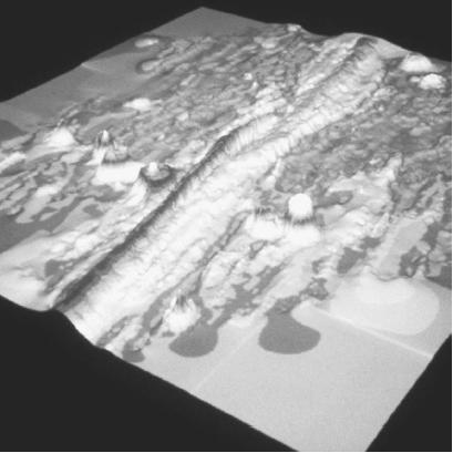
Given what we have seen about continental drift and seafloor spreading, it should come as no surprise to learn that, generally speaking, the deeper one goes in the ocean, the newer the crust. Specifically, the crust is youngest near the center of ocean basins and particularly along mid-ocean ridges, or submarine mountain ridges where new seafloor is created by seafloor spreading.
It also should not be surprising to learn that oceanic and continental crusts differ both in thickness and in composition. Basalt, an igneous rock (rock formed from the cooling of magma), makes up the preponderance of ocean crust, whereas much of the continental crust is made up of granite, another variety of igneous rock. Whereas the ocean crust is thin, generally 3-6 mi. (5-10 km) in depth, the continental crust ranges in thickness from 12.5-55 mi. (20-90 km). This results in a difference in thickness for the lithosphere, which is only about 60 mi. (100 km) thick beneath the oceans but about 2.5 times as thick—150 mi. (250 km)—under the continents.
WHERE TO LEARN MORE
Erickson, Jon. Plate Tectonics: Unraveling the Mysteries of the Earth. New York: Facts on File, 1992.
Gallant, Roy A. Dance of the Continents. New York: Benchmark Books, 2000.
Geology: Plate Tectonics (Web site). <http://www.ucmp.berkeley.edu/geology/tectonics.html>.
Kious, W. Jacquelyne, and Robert I. Tilling. This Dynamic Earth: The Story of Plate Tectonics. U.S. Geological Survey (Web site). <http://pubs.usgs.gov/publications/text/dynamic.html>.
Miller, Russell. Continents in Collision. Alexandria, VA: Time-Life Books, 1987.
Plate Tectonics (Web site). <http://www.platetectonics.com/>.
Plate Tectonics (Web site). <http://observe.ivv.nasa.gov/nasa/earth/tectonics/Tectonics1.html>.
Plate Tectonics, the Cause of Earthquakes (Web site). <http://www.seismo.unr.edu/ftp/pub/louie/class/100/plate-tectonics.html>.
Silverstein, Alvin, Virginia B. Silverstein, and Laura Silverstein Nunn. Plate Tectonics. Brookfield, CT: Twenty-First Century Books, 1998.
Wynn, Charles M., Arthur W. Wiggins, and Sidney Harris. The Five Biggest Ideas in Science. New York: John Wiley and Sons, 1997.
KEY TERMS
ASTHENOSPHERE:
A region of extremely high pressure underlying the lithosphere, where rocks are deformed by enormous stresses. The asthenosphere liesat a depth of about 60-215 mi. (about100-350 km).
COMPRESSION:
A form of stress produced by the action of equal and opposite forces, the effect of which is to reduce the length of a material. Compression is a form of pressure.
CONTINENTAL DRIFT:
The theory that the configuration of Earth's continents was once different than it is today; that some of the individual landmasses of today once were joined in other continental forms; and that these landmasses later separated and moved to their present locations.
CONVERGENCE:
A tectonic process whereby plates move toward each other. Usually associated with subduction, convergence typically occurs in the ocean, creating an oceanic trench. It is one of the three ways, along with divergence and transform motion, that plates interact.
CORE:
The center of Earth, an area constituting about 16% of the planet's volume and 32% of its mass. Made primarily of iron and another, lighter element (possibly sulfur), it is divided between a solid inner core with a radius of about 760 mi.(1,220 km) and a liquid outer core about1,750 mi. (2,820 km) thick.
CRUST:
The uppermost division of the solid earth, representing less than 1% of its volume and varying in depth from 3-37 mi.(5-60 km). Below the crust is the mantle.
DIVERGENCE:
A tectonic process whereby plates move away from each other. Divergence results in the separation of plates and is associated most often either with seafloor spreading or with the formation of rift valleys. It is one of the three ways, along with convergence and transform motion, that plates interact.
EPEIROGENESIS:
One of two principal forms of tectonism, the other beingorogenesis. Derived from the Greek words epeiros ("mainland") and genesis ("origins"), epeirogenesis takes the form of either uplift or subsidence.
FAULT:
An area of fracturing between rocks resulting from stress.
FOLD:
An area of rock that has been bent by stress.
GEOPHYSICS:
A branch of the earth sciences that combines aspects of geology and physics. Geophysics addresses the planet's physical processes as well as its gravitational, magnetic, and electric properties, and the means by which energy is transmitted through its interior.
HISTORICAL GEOLOGY:
The study of Earth's physical history. Historical geology is one of two principal branches of geology, the other being physical geology.
LITHOSPHERE:
The upper layer of Earth's interior, including the crust and the brittle portion at the top of the mantle.
MA:
An abbreviation used by earth scientists, meaning "million years." When an event is designated as, for instance, 160 Ma, it means that it happened 160 million years ago.
MANTLE:
The thick, dense layer of rock, approximately 1,429 mi. (2,300 km) thick, between Earth's crust and its core.
MID-OCEAN RIDGES:
Sub marine mountain ridges where new seafloor is created by seafloor spreading.
OCEANIC TRENCH:
A deep depression in the ocean floor caused by the convergence of plates and the resulting subduction of one plate.
OROGENESIS:
One of two principal forms of tectonism, the other being epeirogenesis. Derived from the Greek words oros ("mountain") and genesis ("origin"), orogenesis involves the formation of mountain ranges by means of folding, faulting, and volcanic activity. The processes of oro-genesis play a major role in plate tectonics.
PALEOMAGNETISM:
An area of historical geology devoted to studying the direction and intensity of magnetic fields in the past, as discerned from the residual magnetization of rocks.
PLATE MARGINS:
Boundaries between plates.
PLATE TECTONICS:
The name both of a theory and of a specialization of tectonics. As an area of study, plate tectonics deals with the large features of the lithosphere and the forces that fashion them. As a theory, it explains the processes that have shaped Earth in terms of plates and their movement. Plate tectonics theory brings together aspects of continental drift, seafloor spreading, seismic and volcanic activity, and the structures of Earth's crust to provide a unifying model of Earth's evolution. It is one of the dominant concepts in the modern earth sciences.
PLATES:
Large movable segments of the lithosphere.
RADIOACTIVITY:
A term describing a phenomenon whereby certain materials are subject to a form of decay brought about by the emission of high-energy particles or radiation. Forms of particles or energy include alpha particles (positively charged helium nuclei), beta particles (either electrons or subatomic particles called positrons), or gamma rays, which occupy the highest energy level in the electromagnetic spectrum.
REMOTE SENSING:
The gathering of data without actual contact with the materials or objects being studied.
RIFT:
A split between two bodies (for example, two plates) that once were joined.
RIFT VALLEY:
A long trough bounded by two or more faults.
SEAFLOOR SPREADING:
The theory that seafloors crack open along thecrests of mid-ocean ridges and that new seafloor forms in those areas.
SHEAR:
A form of stress resulting from equal and opposite forces that do not act along the same line. If a thick, hard-bound book is lying flat and one pushes the front cover from the side so that the covers and pages are no longer perfectly aligned, this is an example of shear.
STRESS:
In general terms, any attempt to deform a solid. Types of stress includetension, compression, and shear. More specifically, stress is the ratio of force to unit area F/A, where F is force and A area.
SUBDUCTION:
A tectonic process thatresults when plates converge and one plate forces the other down into Earth's mantle. As a result, the subducted plate eventually undergoes partial melting.
SUBSIDENCE:
A depression in Earth's crust.
TECTONICS:
The study of tectonism, including its causes and effects, most notably mountain building.
TECTONISM:
The deformation of the lithosphere.
TENSION:
A form of stress produced by a force that acts to stretch a material.
THEORY:
A general statement derived from a hypothesis that has withstood sufficient testing.
TRANSFORM MOTION:
A tectonic process whereby plates slide past eachother. It is one of the three ways, along with convergence and divergence, that plates interact.
Comment about this article, ask questions, or add new information about this topic: