Geomorphology - How it works
An Evolving Area of Study
Geomorphology is an area of geology concerned with the study of landforms, with the forces and processes that have shaped them, and with the description and classification of various physical features on Earth. The term, which comes from the Greek words geo, or "Earth," and morph, meaning "form," was coined in 1893 by the American geologist William Morris Davis (1850-1934), who is considered the father of geomorphology.
During Davis's time, geomorphology was concerned primarily with classifying different structures on Earth's surface, examples of which include mountains and islands, discussed later in this essay. This view of geomorphology as an essentially descriptive, past-oriented area of study closely aligned with historical geology prevailed throughout the late nineteenth and early twentieth centuries.
By the mid-twentieth century, however, the concept of geomorphology inherited from Davis had fallen into disfavor, to be replaced by a paradigm, or model, oriented toward physical rather than historical geology. (These two principal branches of geology are concerned, in the first instance, with Earth's past and the processes that shaped it and, in the second instance, with Earth's current physical features and the processes that continue to shape it.)
RETHINKING GEOMORPHOLOGY.
As reconceived in the 1950s and thereafter, geomorphology became an increasingly exact science. As has been typical of many sciences in their infancy, early geomorphology focused on description rather than prediction and tended to approach its subject matter in a qualitative fashion. The term qualitative suggests a comparison between qualities that are not defined precisely, such as "fast" and "slow" or "warm" and "cold." On the other hand, a quantitative approach, as has been implemented for geomorphology from the mid-twentieth century onward, centers on a comparison between precise quantities—for instance, 10 lb. (4.5 kg) versus 100 lb. (45 kg) or 50 MPH (80.5 km/h) versus 120 MPH (193 km/h).
As part of its shift in focus, geomorphology began to treat Earth's physical features as systems made up of complex and ongoing interactions. This view fell into line with a general emphasis on the systems concept in the study of Earth. (See Earth Systems for more about the systems concept.) As geomorphology evolved, it became more interdisciplinary, as we shall see. This, too,
Landforms and Processes
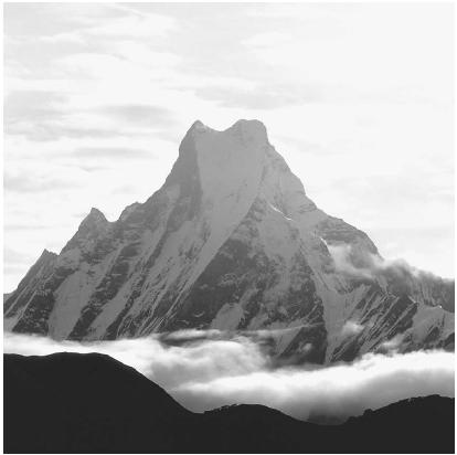
Two concerns are foremost within the realm of geomorphology, and these concerns reflect the stages of its history. First, in line with Davis's original conception of geomorphology as an area of science devoted to classifying and describing natural features, there is its concern with topography. The latter may be defined as the configuration of Earth's surface, including its relief (elevation and other in equalities) as well as the position of physical features.
These physical features are called landforms, examples of which include mountains, plateaus, and valleys. Geomorphology always has involved classification, and early scientists working in this subdiscipline addressed the classification of landforms. Other systems of classification, however, are not so concerned with cataloging topographical features themselves as with differentiating the processes that shaped them. This brings us to the other area of interest in geomorphology: the study of how landforms came into being.
SHAPING THE EARTH.
Among the processes that drive the shaping of landforms is plate tectonics, or the shifting of large, movable segments of lithosphere (the crust and upper layer of Earth's mantle). Plate tectonics is discussed in detail within its own essay and more briefly in other areas throughout this book, as befits its status as one of the key areas of study in the earth sciences.
Other processes also shape landforms. Included among these processes are weathering, the breakdown of rocks and minerals at or near the surface of Earth due to physical or chemical processes; erosion, the movement of soil and rock due to forces produced by water, wind, glaciers, gravity, and other influences; and mass wasting or mass movement, the transfer of earth material, by processes that include flow, slide, fall, and creep, down slopes. Also of interest are fluvial and eolian processes (those that result from water flow and wind, respectively) as well as others related to glaciers and coastal formations.
Human activity also can play a significant role in shaping Earth. This effect may be direct, as when the construction of cities, the building of dams, or the excavation of mines alters the landscape. On the other hand, it can be indirect. In the latter instance, human activity in the biosphere exerts an impact, as when the clearing of forest land or the misuse of crop land results in the formation of a dust bowl.
Interdisciplinary Studies
As noted earlier, geomorphology is characteristic of the earth sciences as a whole in its emphasis on an interdisciplinary approach. As is true of earth scientists in general, those studying landforms and the processes that shape them do not work simply in one specialty. Among the areas of interest in geomorphology are, for example, deep-sea geomorphology, which draws on oceanography, and planetary geomorphology, the study of landscapes on other planets.
When studying coastal geomorphology, a geologist may draw on realms as diverse as fluid mechanics (an area of physics that studies the behavior of gases and liquids at rest and in motion) and sedimentology. The investigation of such processes as erosion and mass wasting calls on knowledge in the atmospheric sciences as well as the physics and chemistry of soil. It is almost inevitable that a geomorphologic researcher will draw on geophysics as well as on such subspecialties as volcanology. These studies may go beyond the "hard sciences," bringing in such social sciences as geography.
Comment about this article, ask questions, or add new information about this topic: